Up on the Downs!
- Heather Newman

- Aug 5, 2020
- 4 min read
Yesterday I went for a walk that I have done many times. The walk is a wonderful mix of farmland, downland, ridges, and history!
The walk starts at the beautiful village of Bratton in Wiltshire. Bratton is a village with a very pretty church (St James the Great) that has a very interesting path to access it! The path was paved so that the women parishioners could walk to church without dirtying their wide crinoline dresses!

The church sits outside of the village - rather than in the centre where they usually are situated - there are several suggestions for why this is. There is the suggestion that it was also serving the smaller village of Littlestoke which disappeared around 1348 (another great year for a pandemic), either from the population of the village being killed off or because they chose to move to a better location potentially joining Bratton itself. Lots of villages ceased to be during the plague, not necessarily because of death but because villages needed certain trades to be viable such as a blacksmith, farmers and even an Alewife (ale was a way of drinking water that was safe) and so the remaining members of the village would have to join another more sustainable community.

From the village of Bratton it is then a steep walk up Combe Bottom to reach the top of the ridge and join the Wessex Ridgeway long distance path which runs from Marlborough in Wiltshire and reaches the sea at Lyme Regis in Dorset. The ridge makes up the southern end of the Greater Ridgeway which is made up of the Ridgeway, Icknield Way and the Peddars Way and links Hunstanton in Norfolk with Dorset; the route was used in its entirety for nearly 5,000 years as it was a safe and reliable trade route.

Once at the top the path then takes you around Bratton Camp on battlements which were erected around 2,000 years ago during the Iron Age. However the battlements are best known for their importance during the Saxon era as the supposed site of the Battle of Ethandun in 878 which was the decisive battle between Alfred the Great and the Danes - if Alfred had lost the battle he may have lost Wessex forever but his victory secured it from Danish rule. Hillforts were built on high hills for better defence and if you did manage to run to the top then you were met with ballestrades and a fresh fighting force!

Perhaps the most famous thing on Bratton Camp however is not the hillfort it is the Westbury White Horse, the current one dating from 1778. In Wiltshire folklore when the clock of Bratton church strikes midnight, the horse goes down to the Bridewell Springs - below the hill - to drink. By the 1950s the chalk was getting hard to manage and so the Westbury council had it concreted to make it easier to clean - rather than rechalking which is where chalk is crushed into a paste and put across the figure, instead, it could be cleaned by men abseiling down onto it!

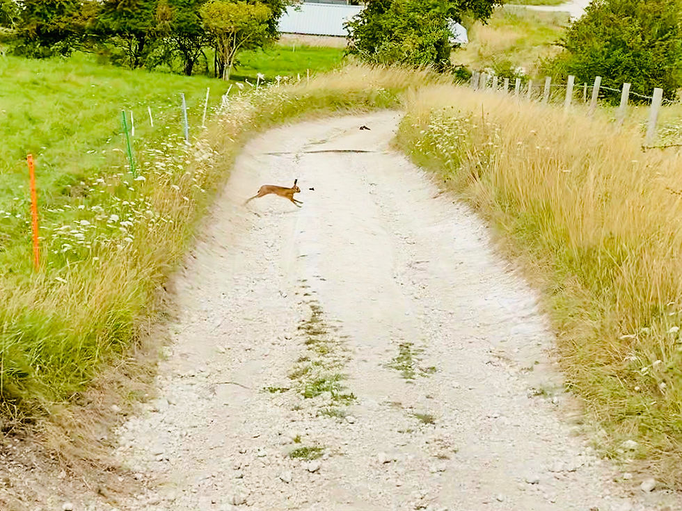
Next there is a nice long flat straight that takes you above the town of Westbury and along the top of the Upton Cow Down, following the edge of the live firing area of the militaries Salisbury Plain Training Area before heading steeply down and back up - now heading towards the town of Warminster. This is a lovely section of downland and there is always plenty of wildlife to keep an eye out for - I was lucky enough to see several Hares and some lovely little Wall Butterflies!!

The walk then heads down into the edge of Warminster and after a walk through the military married quarters, you are back onto beautiful unspoilt downland! The first hill you reach is Battlesbury Hill, an iron age hill fort which is almost a mile around!! There have now been Bronze Age remains and ramparts found underneath the Iron Age - making it much older than previously thought. However, it seems that the inhabitants met an unfortunate end either at the hands of Roman legions or through intertribal wars just before the Roman invasion - the evidence of this is many burial chambers around the gates - the picture below shows one of the gates. The silver star in the picture is to signify where not to dig - mainly so that soldiers on practice manoeuvres don't become inadvertant archaeologists while digging a fox hole!

From there you walk down the hill and back up onto another - smaller - hill which has Bronze Age remains on it, Middle Hill. As well as having a round burial chamber on the top the hill boasts some fantastic Strip Lynchets which were a medieval terraced farming system and in the right season boast some stunning wild flowers especially Orchids - here are some Orchids that were on the hill side earlier in the summer...


From Middle Hill you then walk across onto the hillfort of Scratchbury Hill and Cotley Hill which has the oldest of all the remains as it has 'Gruffy Ground' which is scrap heaps from Neolithic flint quarrying. Because it sits on chalk downland it is a great place to find flint - the reason that they are often found together is that chalk is the bones of prehistoric sea creatures (the area being a shallow sea) and the flint is the soft tissue of the creatures! Here is the view from Cotley Hill down to the village of Norton Bavant which is the endpoint of the walk - this picture was taken earlier in the year.

Comments